


AltiCalc app for iPhone and iPad
Calculate the height or altitude of model rockets and airplanes using one or two trackers or two pairs of trackers in competition. AltiCalc can also be used for simple height surveys.
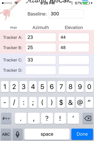
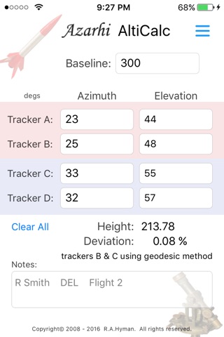
Calculations are performed using two trackers or theodollites set a distance apart along a baseline. At the maximum altitude, tracking stops and the azimuth and elevation from each tracker are input into Alticalc, along with the baseline distance. The attitude is then calculated with the deviation or error. Competition rules specify the allowable error percentage. The altitude is calculated in whatever units the baseline was entered, feet or meters for example.
Application features:
- Set the number of trackers being used
- In competition, trackers are used in pairs. AltiCalc takes all tracker information and returns altitude calculations for the pair of trackers yielding the lowest error rates.
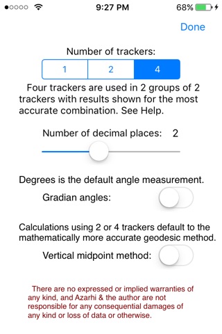
- Switch between degrees or gradian angles for input
- Switch between the vertical midpoint method of calculation or the more accurate geodesic method.
- set the number of decimal places shown in the results.
A switch for four trackers can be set on Alticalcs Options page. Four trackers are sometimes used in competition, set up in two pairs at the ends of the baseline. Data from all four trackers are entered into AltiCalc. All tracker pairs are then used by AltiCalc to find the pair of trackers yielding the altitude calculation with the lowest deviation. The data from tracker A is used with the data from tracker C and then tracker D. The data from tracker B is then used with data from trackers C and D. The results with the lowest deviation are displayed in AltiCalc.
AlitCalc can also be used as a simple surveying tool to determine the height of an object. Just set the single tracker switch on AltiCalcs Options page. The baseline must be entered that is the distance from the tracker or theodolite to the object being measured. Enter the single elevation and the height is calculated.
The calculations performed by AltiCalc are specified by the National Association of Rocketry in the official competition Sporting Code. Find this at www.nar.org. Azimuth and elevation angles are typically entered in degrees; a switch on the Options page allows for gradian degrees. Calculations for two or four trackers are performed using the geodesic method, while the vertical midpoint method can be set on the Options page for historical purposes.
The number of decimal places displayed in results can be set on the Options page. Typically 2 decimal places are recorded, because more decimal places are usually meaningless given the accuracy of trackers and operators.